The Bentley Trail is actually a trail system beginning at the White Deer Lake settlement with the main branch ending at Mr. Bentley's cabin on Lake Superior in the Huron Mountain Club. The trails were made between 1904 and 1920. Most were made to be walked by the guests including the women in dresses with their parasols. They were used to lead to interesting points in the area or as a walkthrough to the Huron Mountain Club (the main trail). Today only periodic remnants of some of the trails remain. This page contains maps of the trail locations. The first one is an old map made by Bentley himself. The others are modern topos showing the routes of some of the existing but hard to find trails as walked by the author and mapped with a GPS.
Click on these maps for larger versions.
This is a map made by Bentley of all the trails.
Note that from my experience many of the positions are not accurate.
This map links to a larger version stored as a gif file.
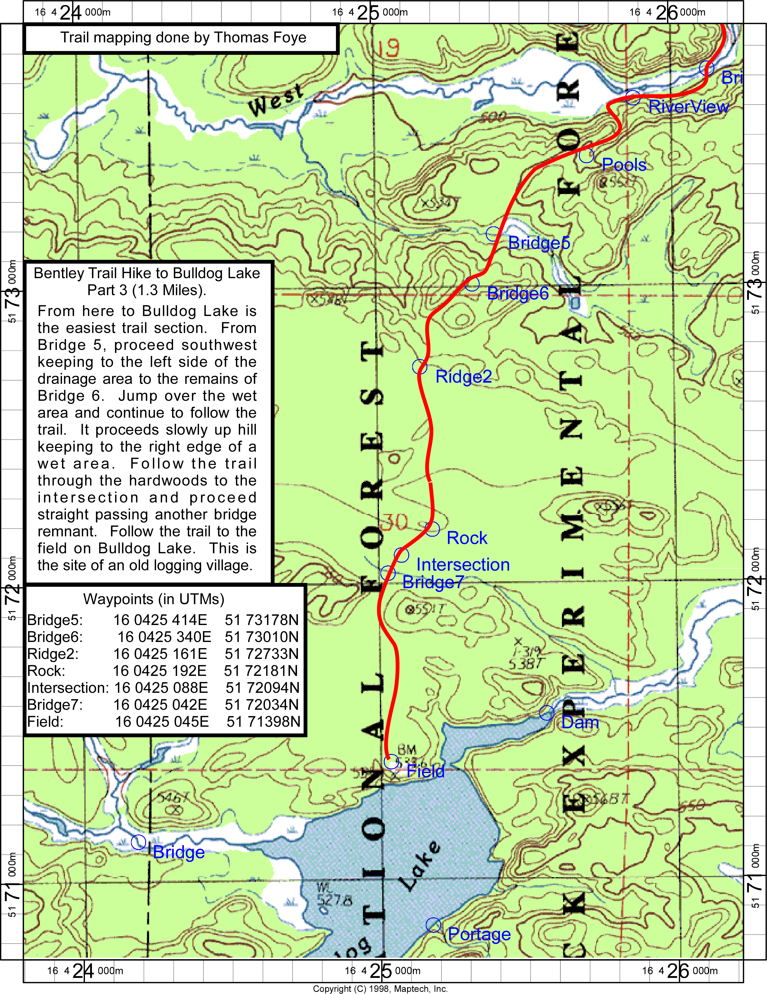
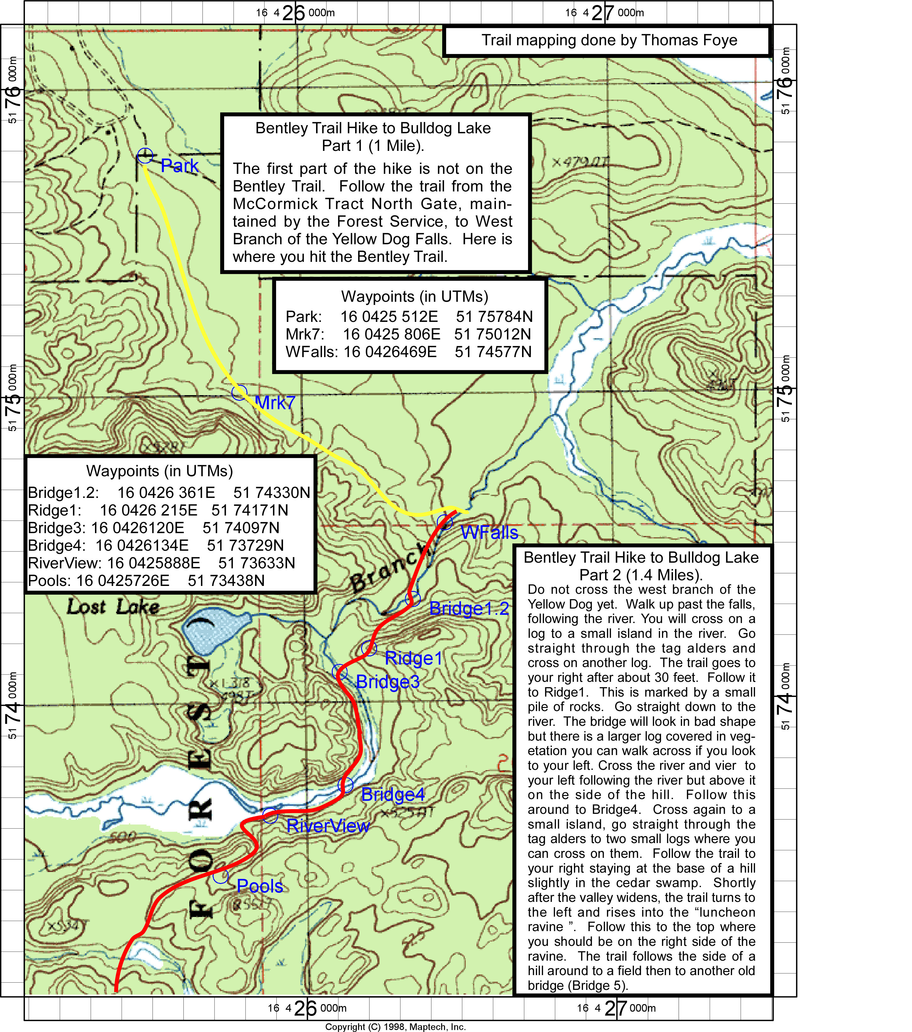
Maps of the Main Trail from North Gate to Bulldog Lake.
Note: The segment from West Falls to the Parking lot (North Gate) was not part of the original trail, but is currently maintained by the Forest Service. The Bentley itself is not maintained and is difficult to find in many places. It is more easily hiked in the spring or fall when the leaves are off the trees.
Bentley Trail - Part 1 & Part 2.
Bentley Trail - Part 3.