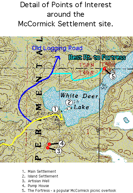
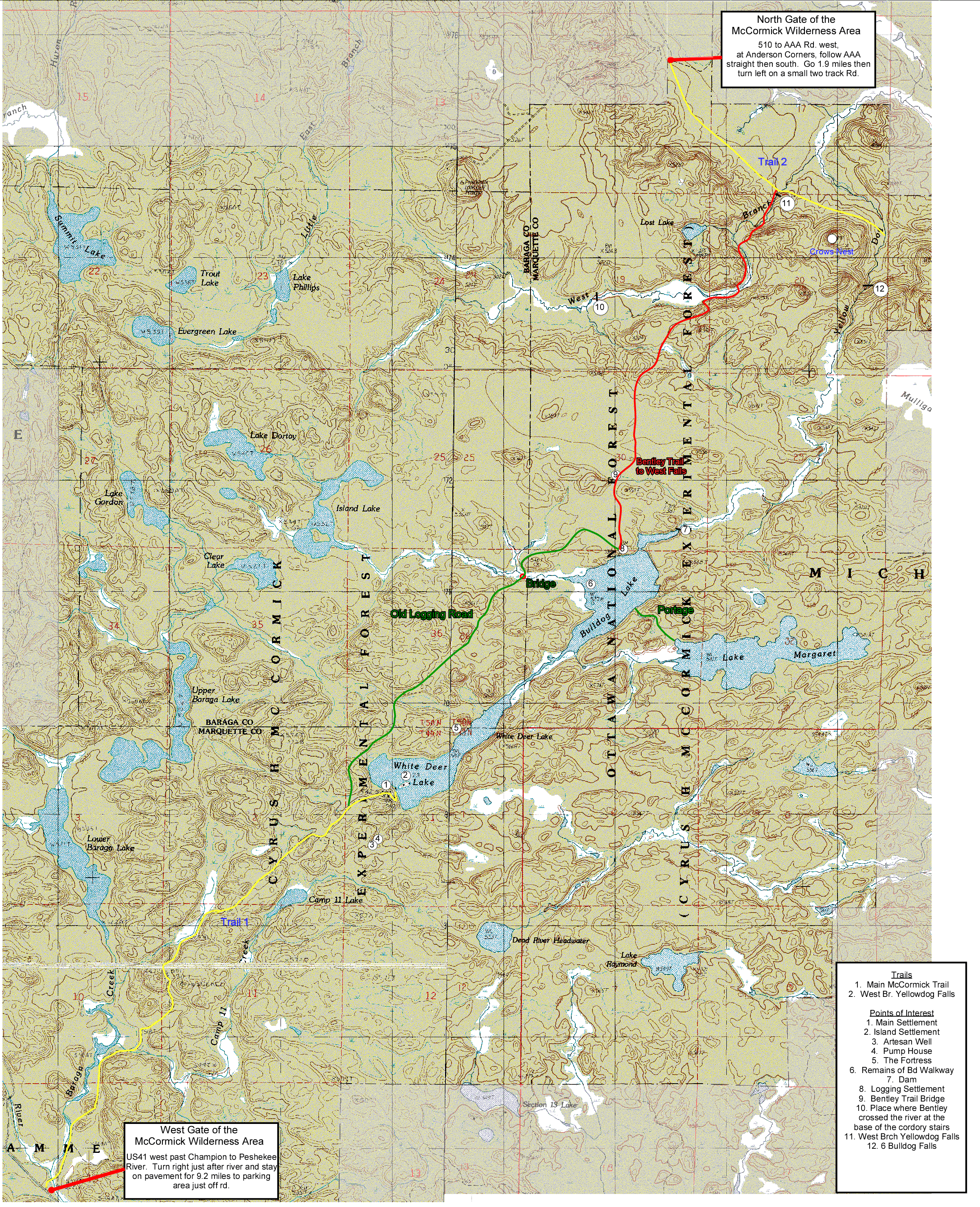
Click on these maps for larger versions.
Topo Map of the entire McCormick Tract with locations of the Photos.
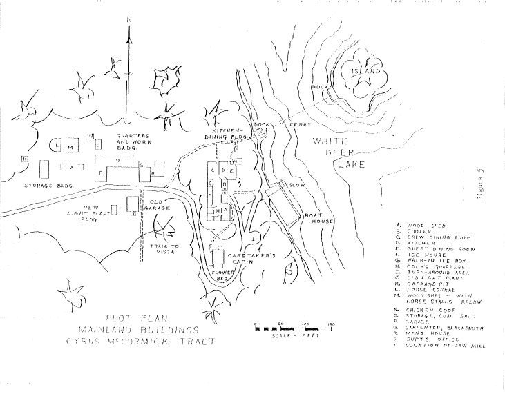
Settlement Buildings
(from Ref # 2 in History)
Island Buildings
(from Ref # 2 in History)

Michigan Historical Archives Map 1
1924 Trail Map

Michigan Historical Archives Map 2
1908 Trail Map

Michigan Historical Archives Map 3
First 2/3 of South Trail - Early Road Map

Michigan Historical Archives Map 4
Logging Road Map from Whitedeer to Bulldog Lake
Today this is a barily visible trail!